Observations all along the line - Kimball & the Southern Panhandle First
Observations all along the line - Kimball & the Southern Panhandle First
Blizzard Blitzes Kimball & Panhandle In Multi-Day Weather Event
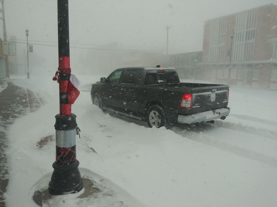
This was the scene, during what was supposed to be daylight on East 2nd Street in downtown Kimball, as the winter storm hit Tuesday. For hours upon hours, the conditions amounted to biting winds, swirling and accumulating snow, and poor visibility.
The blizzard that clobbered Kimball and the Panhandle on Tuesday lived up to the hype.
The relentless winter storm bashed the area with gusts up to 65 mph, wickedly swirling snow that caused whiteout conditions for hours on end.
By the time the worst of the storm was forecast to end late Wednesday, perhaps 12-18 inches of snows was expected to accumulate.
A Panhandle Alert was issued late Tuesday afternoon urging people to stay off icy, snowpacked roads that should be used by emergency vehicles only.
Beyond that, just about everything was threatened, closed or canceled:
• Kimball, Kimball County and Kimball Public Schools buildings, services and activities.
• Interstate 80 and Highways 30 and 71.
• Normal business operations, including the Observer's usual Wednesday print and delivery schedule.
The National Weather Service in Cheyene said mid-day Tuesday that blizzard and whiteout conditions were ongoing across several portions of the Nebraska Panhandle – with Chadron, Kimbal and Sidney some of the harder hit areas.
Additional bands of moderate to heavy snow were expected to continue for the Northeast Panhandle and East Wyoming High Plains through midday Wednesday.
NWS reported strong northwest winds of 30-45 mph and gusts upwards of 60-65 mph were occurring and expected to persist through Wednesday evening. Prolonged elevated winds were anticipated Thursday and Friday – causing additional blowing snow issues.
Wind chills were expected to remain near to below zero through Thursday. Cold air will stay in place this weekend and next week.